03563-250067, 8436238571

| PROSPECTUS | DoSIER 2024

Department of Geography

  • About
  • Faculty Profile
  • Notice
  • Program Offered
  • Syllabus
  • Program Outcome
  • Course Outcome
  • Routine
  • Pass Out Students
  • Running Students
  • Students Progression
  • Students Achievement
  • Academic Resource
  • Activities
  • Result Analysis
  • Gallery
  • Answer Script Submission

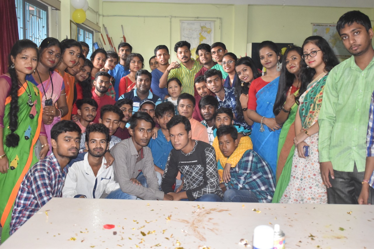
ABOUT THE DEPARTMENT

The Department of Geography had started its journey in the year of 2013. Consecutively, honours class was introduced in 2017. At present, it has 4 faculty members and around 54 students who are approaching towards their Bachelor’s degree. The Department of Geography strives to develop a questioning mind, make learning a pleasure, and prepare the students for placement. The department aims at directing students to higher academics or professional courses.

The curriculum involves writing papers, conducting exhibitions, tutorials, fieldwork, and participation in household surveys, practical and map-making methods. Both theoretical knowledge and practical skills are imparted through use of modern ICT, supplemented by field excursions to geographically significant locations. Knowledge of Remote Sensing and Geographical Information System (GIS) mapping has high demand employability.

Courses offered:

Courses offered by the Geography Department include 3 years Honours Degree Course and the 3 years General Degree Course.

Our Vision:

To be the leading Geography department among the colleges of North Bengal University. To become the  torchbearer towards creative, cutting-edge research that defines the evolving discipline and fuels the education systems.

Our Mission:

  • Commitment to undergraduate students to provide a learning environment that fosters knowledge, skills and experiences that prepare them for life in an ever-changing world, and engages, inspires and  challenges them to become informed global citizens.

  • Commitment to provide a research-based, mentorship model of graduate education, and to graduate  students who meet the highest international standards.
  • Service to the community by disseminating geographic knowledge and by providing geographic insights on important societal issues.

Department of Geography

Course Offered:
This Department offers

  1. B.A. Honours in Geography
  2. B.A. Programme Course with Geography

PROGRAMME OUTCOME

Geography is the study of places and the relationships between people and their environments. Geographers explore both the physical properties of Earth’s surface and the human societies spread across it. They also examine how human culture interacts with the natural environment and the way those locations and places can have an impact on people. Geography seeks to understand where things are found, why they are there, and how they develop and change over time. The study of the diverse environments, places, and spaces of Earth’s surface and their interactions. It seeks to answer the questions of why things are as they are where they are. The modern academic discipline of geography is rooted in ancient practice, concerned with the characteristics of places, in particular their natural environments and peoples, as well as the relations between the two.

COURSE OUTCOME

Course Outcome (Honours)

CC1-01PR (Geotectonics)
  • The main practical topics are map scale and map projection. The map scales are used to determine physical distance and size of geographical area.
  • It indicates the distance between 2 points on a map bears the distance between the corresponding points on the actual ground.
  • The method used to portray a part of the spherical Earth on a flat surface whether a paper map or a computer.
  • In other words a map projection systematically renders a 3D ellipsoid of Earth to a 2D map surface. 3D services cannot be perfectly displayed in two dimensions hence distortions occur.
  • Therefore each type of projection preserves a particular property distorting the other properties.
  • It is up to the cartographer to determine which projection is most suitable for this purpose.
CC1-02PR (Geomorphology)
  • Topographic maps show physical and cultural features with the help of conventional symbols. It has multiple uses in the present day in any type of Geographic planning or large scale architecture, earth sciences, civil engineering and even the present Remote Sensing and GIS.
  • The study of Rocks and Minerals help students understand the constituent minerals they are composed of and structure, the relationship between rocks and landform features.
Course Code: GEO-H-CC-2-03-PR–Practical (Human Geography)
  • While studying human geography students will learn how spatial processes such as migration, landscape change and spatial planning shape people's lives and activities.
  • The study of these devices and tools which are involved in their construction and use.
  • Practical approach explains the techniques of surveying and Cartography, using mathematical and Statistical methods.
GEO-H-CC-2-04-PR – Practical
  • The primary aim of studying settlement geography is to acquaint with the spatial and structural characteristics of human settlements under varied environmental conditions.
  • It helps to identify the economic and social development of a place and can show its main activity.
  • Most large settlements have more than one function though in the past one function was maybe the most important in defining the success and growth in importance of the settlement.
CC3-05-PR (Climatology)
  • The topic includes meteorological instruments and daily weather interpretation and representation of the climatic data.
  • These topics help students learn how to measure the air temperature, air pressure on a daily or monthly basis.
  • The topic also helps to learn to interpret the symbols used in Indian weather maps and analyze and how to represent climatic data through the technique of climograph and hythergraph.
CC3- 06-PR (Statistical method in geography)
  • The topics include basic statistical terms, calculation of measures of Central tendency correlations.
  • The topics are mathematical science that works with numerical data.
  • It helps better understanding and accurate description of nature's phenomena and also helps in efficient planning in many fields of study.
  • It helps to form a base for research and how real life experiments of a phenomenon can be numerically validated.
CC3-07-PR (Geography of India)
  • The topics of study are rainfall and temperature graphs in selected stations and decadal growth rate of population. The inequality measuring methods are Lorenz curve and Gini coefficient.
  • The farmer is the graphical method of expression and the letter is the mathematical method of measuring the inequality regarding any population nature.
  • The students will learn about the various ways of expressing the population characteristics.
Course Code: GEO-H-CC4-08-PR –Practical (Economic Geography)
  • Economic geography is a sub-field within the larger subjects of geography and economics.
  • Researchers within this field study the location, distribution, and organization of economic activity around the world.
  • Economic Geography is important in both developed and underdeveloped nations such as the United States, India, China, Bangladesh because it allows researchers to understand the structure of the area's economy and its economic relationship with other areas around the world.
Course Code: GEO-H-CC4-09-PR – Practical (Regional Planning and Development)
  • Regional Planning is a multidisciplinary approach which aims at holistic development of a region.
  • Regional Planning is a specific type of planning, based on, specific planning structure for inducing public action aimed at societal wellbeing.
  • It implies that Regional Planning is concerned fundamentally with the society in the context of space.
  • Regional Planning is considered as a geo-technology for comprehensive development of regions through rational transformation of regional space.
  • It seeks to recognize space more rationally with a view to achieving greater regional integration
  • Field research is defined as a qualitative method of data collection that aims to observe, interact and understand people while they are in a natural environment. For example, nature conservationists observe behavior of animals in their natural surroundings and the way they react to certain scenarios. In the same way, social scientists conducting field research may conduct interviews or observe people from a distance to understand how they behave in a social environment and how they react to situations around them.
  • To complete and analyze a few objectives students need to follow a distinct methodology. 4th semester (H) and 6th semester (H) students of 2022 went to Dzongri village, Upper Pelling, Sikkim to study and observe their way of life to cope up with landslide hazards.
CC5-11-PR (Environmental geography)  
  • The content for both Honors and Program courses are the same in this paper. The content of the course is preparation of a project report based on environmental problems.
  • The syllabus will make the students learn and practically understand the burning environmental issues today.
  • They will be more aware about the problem as well as they will learn how to design, collect data and assimilate as well as write a project report
CC5-12-PR (Remote sensing and GIS)
  • This is the new development as well as the most advanced topic in geography as a science.
  • The knowledge of Remote sensing and GIS as well as the aerial photo interpretation, satellite imagery image processing classification etc. constitute the content of this paper.
  • The content will help the students learn about the new techniques in Remote Sensing and GIS, their application in various subjects and the importance of these modern techniques which is very vital in the modern times.
DSE 5-01-PR (Population Geography)
  • The content includes population projection, density mapping, and work participation rate.
  • The topics help to learn about the population projection, the concept of density of the population, area identification of low and high density, and its relationship with other causal factors for population growth and distribution.
  • The study also includes the number of people participating in different sectors of the economy which help to identify the real life situation of the people participating as there will be use of authentic data like Census of India, NSSO. etc
GEO-DSE5-02-PR (Urban geography)
  • In this paper, topics include rank size method, State wise variation and trend in urbanization.
  • The paper helps to understand the pattern of distribution of urban centers scientifically.
  • Rank size method is one of the accepted methods for studying or analyzing the pattern of distribution of urban centers.
  • The exact state wise variation and trend of urbanization can be observed from the data taken from census population.
Course Code: GEO-H-DSE-6-03-PR (Advanced Cartography)
  • Cartography or mapmaking is the study and practice of making maps .Map making involves the application of both scientific and artistic elements, combining graphic talents and specialized knowledge of compilation and design principles with available techniques for product generation.
  • Map function as visualization tools for spatial data. Spatial data is stored in a database and extracted for a variety of purposes.
  • The traditional analog methods of map making have been replaced by digital interactive maps that can be manipulated digitally.
  • Modern cartography like many other fields of “information technology” has undergone.
  • Rather than merely drawing maps the cartographic process is concerned with I) Data manipulation, II) Data capture, III) Image processing and IV) Visual display.
  • Cartographic representations may appear in printed form or as dynamic images generated on a computer display screen.
  • Computer assisted mapping systems have added a new and exciting dimension to cartographic techniques and traditional methodologies have to be augmented with new skills. The fundamental nature of cartography has changed with the evolving technologies, providing cartographers with new methods for visualization and communication of spatial information.
Course Code: GEO-H-DSE-6-04-PR (Social Geography)
  • Social geography is the branch of human geography that is interested in the relationships between society and space, and is most closely related to social theory in general and sociology in particular, dealing with the relation of social phenomena and its spatial components. In a nutshell, social geography focuses on the scientific study of the relationship of society and space (spatial components).
  • It is interested in answering the questions of how societal processes determine space and its structures and how spatial conditions determine the existence of societies.
 

Course Outcome (Programme Course)

Course Code: GEO-P-CC-1-01-PR: Practical (Physical Geography)
  • Physical geography is the study of the processes that shape the Earth's surface, the animals and plants that inhabit it, and the spatial patterns they exhibit. Self-identified in the mid- to late 1800s, physical geographers and in particular geomorphologists dominated the discipline of geography to the late 1930s
Course Code: GEO-P-CC-2-02-PR: Practical (Human Geography)
  • While studying human geography students will learn how spatial processes such as migration, landscape change and spatial planning shape people's lives and activities.
  • The study of these devices and tools which are involved in their construction and use.
  • Practical Geography: A systematic approach explains the techniques of surveying and Cartography, using mathematical and Statistical methods.
Course Code: GEO-P-CC-3-03-PR (Regional Development)
  • Regional development is a broad term but can be seen as a general effort to reduce regional disparities by supporting (employment and wealth-generating) economic activities in regions
Course Code: GEO-P-CC-4-04-PR (Spatial Information Technology)
  • Spatial information technology aims to provide information about the Earth's surface.
  • It includes all the tools and technologies that enable us to acquire information and provide decision-making capability towards planning and sustainable management.
  • The most important technologies are remote sensing, GPS and GIS.
Course Code: GEO-P-DSE-5-01-PR (Disaster Management)
  • The content for both Honors and Program courses are the same in this paper.
  • The content of the course is preparation of a project report based on environmental problems.
  • The syllabus will make the students learn and practically understand the burning environmental issues today.
They will be more aware about the problem as well as they will learn how to design, collect data and assimilate as well as write a project report
Course Code: GEO-P-DSE-6-02-PR (Climate Change: Vulnerability and Adaptation)
  • Climate change threatens people with food and water scarcity, increased flooding, extreme heat, more disease, and economic loss.
  • Human migration and conflict can be a result. The World Health Organization (WHO) calls climate change the greatest threat to global health in the 21st century.
  • The degree to which a system is susceptible to, or unable to cope with, adverse effects of climate change, including climate variability and extremes.
  • It is a function of the character, magnitude and rate of climate variation to which a system is exposed, its sensitivity, and its adaptive capacity. Climate change adaptation refers to actions that reduce the negative impact of climate change, while taking advantage of potential new opportunities.
  • It involves adjusting policies and actions because of observed or expected changes in climate.
Course Code: GEO-SEC-A-3-01-TH (Remote Sensing)
  • This is the new development as well as the most advanced topic in geography as a science.
  • The knowledge of Remote sensing as well as the aerial photo interpretation, satellite imagery image processing classification etc. constitute the content of this paper.
  • The content will help the students learn about the new techniques in Remote Sensing, their application in various subjects and the importance of these modern techniques which is very vital in the modern times.
Course Code: GEO-SEC-A-4-02-TH: (Geographical Information System)
  • Comprehend fundamental concepts and practices of Geographic Information Systems (GIS) and advances in Geospatial Information Science and Technology (GIS&T).
  • Apply basic graphic and data visualization concepts such as color theory, symbolization, and use of white space.
  • Demonstrate organizational skills in file and database management.
  • Give examples of interdisciplinary applications of Geospatial Information Science and Technology.
  • Apply GIS analysis to address geospatial problems and/or research questions.
  • Demonstrate proficiency in the use of GIS tools to create maps that are fit-for-purpose and effectively convey the information they are intended to.
  • Effectively communicate and present project results in oral, written, and graphic forms.
  • Demonstrate confidence in undertaking new (unfamiliar) analysis using GIS, troubleshoot problems in GIS, and seek help from software/website help menus and the GIS community to solve problems.
  • Apply mathematical concepts, including statistical methods, to data to be used in geospatial analysis.
  • Gather and process original data using a Global Positioning System (GPS) or other Global Navigation Satellite Systems (GNSS).
 

Course Outcome (GE)

COURSE CODE: GEO-GE-01-TH PHYSICAL GEOGRAPHY
  • Learning the Physical Geography and Solar System.
  • Understand the composition and types of rocks.
  • Comprehend the weather phenomena and denudation work.
  • Understand the hydrosphere in detail.
  • Students will get objective types of question and will expose competitive exams
  • Also students will come to types of rocks and their denudation process.
  • Learn the difference between weather and climate.
COURSE CODE: GEO-GE-02-TH GEOGRAPHY OF INDIA
  • Understand the political division of the World.
  • Learning the natural regions of the world.
  • Understand the economic activities of the World.
  • Evaluate the population pattern and distribution.
  • The economic processes operating at different geographical scales are depending on the complex economic-political-social interactions that are framed at the global level.
  • The course explores the processes of globalization and seeks to provide understanding of today’s increasingly interdependent world.
  • Students will be familiarized with economic processes such as globalization, trade and transportation and their impacts on economic, cultural and social activities.
   

Department of Geography

Routine

CLASS ROUTINE 2019
W.E.F-2ND JANUARY, 2023


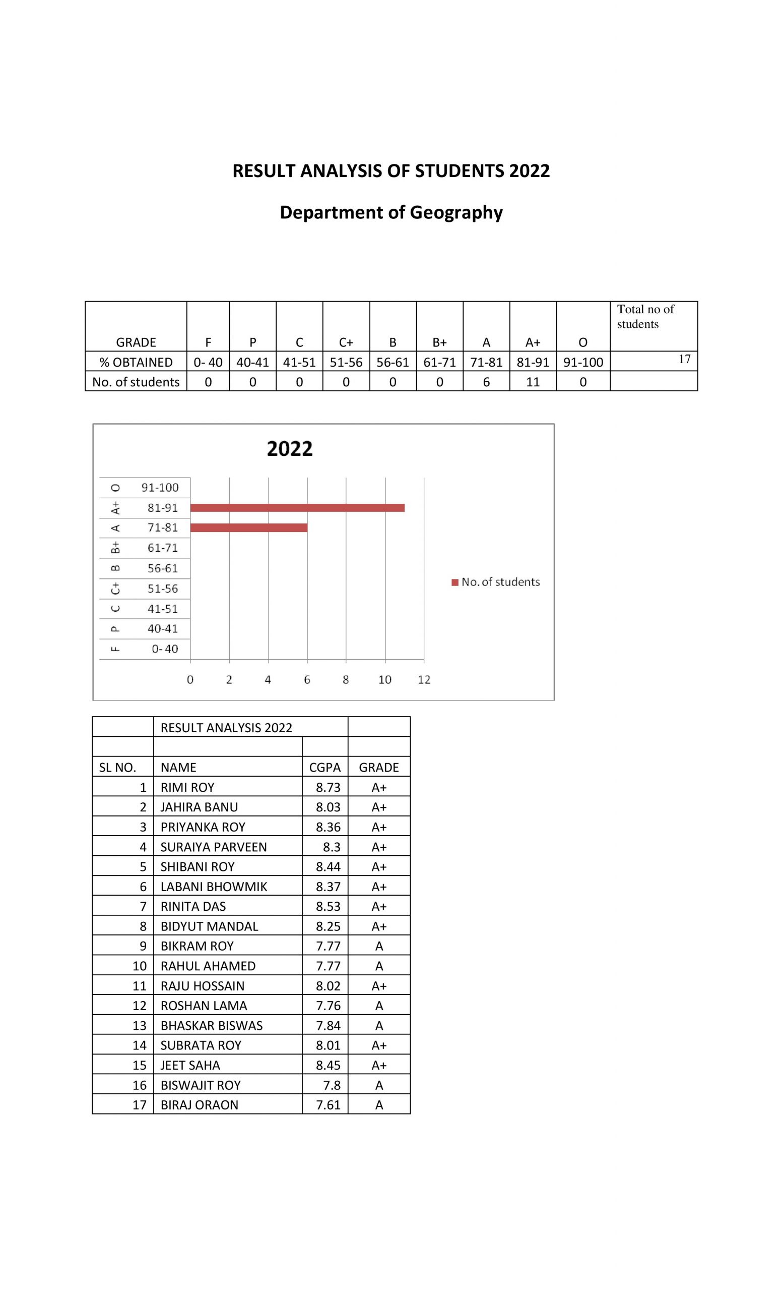
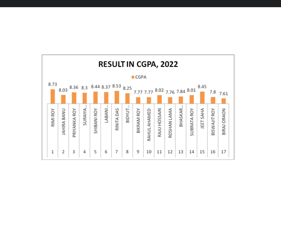
List of Pass Out Students-2022

Sl. No.

NAME Email Address GENDER

CATEGORY/RESERVATION

1 Bikram Roy [email protected] MALE SC
2 Labani Bhowmik [email protected] FEMALE SC
3 Bhaskar Biswas [email protected] MALE SC
4 Rimi Roy [email protected] FEMALE SC
5 Biswajit roy [email protected] MALE SC
6 Bidyut mondal [email protected] MALE SC
7 Bikram roy [email protected] MALE SC
8 RINITA DAS [email protected] FEMALE OBC-B
9 Jahira Banu [email protected] FEMALE OBC-A
10 Roshan Lama [email protected] MALE UNRESERVED
11 Jeet saha [email protected] MALE UNRESERVED
12 Shibani Roy [email protected] FEMALE SC
13 Rahul Ahamed [email protected] MALE OBC-A
14 Raju Hossain [email protected] MALE OBC-A
15 Subrata Roy [email protected] MALE SC

1st Semester Honours

Sl.No

Name of the student Gender Email ID Program name

Year of joining

1 Srabani Sarkar Female [email protected] Honours 2022
2 Jhumpa Roy Female [email protected] Honours 2022
3 Mita Bhowmik Female [email protected] Honours 2022
4 Taniya Roy Female [email protected] Honours 2022
5 Rinku Adhikary Female [email protected] Honours 2022
6 Sonali Oraon Female [email protected] Honours 2022
7 Arif Hossain Male [email protected] Honours 2022
8 Titiksha Roy Female [email protected] Honours 2022
9 Sathi Bhowmik Female [email protected] Honours 2022
10 Ripan Barman Male [email protected] Honours 2022
11 Sangita Roy Female [email protected] Honours 2022
12 Rakhi Mandal Female [email protected] Honours 2022
13 Jhumpa Sarkar Female [email protected] Honours 2022
14 Ramkrishna Ghosh Male [email protected] Honours 2022
15 Utshab ch.Roy Male [email protected] Honours 2022
16 Koushik Roy Male [email protected] Honours 2022
17 Sudeb Das Male [email protected] Honours 2022
18 Subhankar Sakhari Male [email protected] Honours 2022
19 Sushanta Oraon Male [email protected] Honours 2022

4th Semester Honours

Name of the student

Gender Email ID Program name Students ID

Year of joining

Riju Das  Male  [email protected]  Geography honours  120210094148  2021
 Manab Sarkar Male   [email protected]  Geography honours  120210093695  2021
Suhan Sen  Male  [email protected]  Geography honours  120210091828  2021
 Pijush Dutta  Male  [email protected]  Geography honours  120210096868  2021
 Raaz Dhar  Male  [email protected]  Geography honours  120210096862 2021
 Manisha Bhowmik  Female  [email protected]  Geography honours  120210093819 2021
 Anindita Mallick Female   [email protected]  Geography honours  120210093268 2021
 Rini Das  Female  [email protected]  Geography honours  120210094497 2021
 Banasree Barman  Female  [email protected]  Geography honours  120210096161 2021
 Bikram Roy  Male  [email protected]  Geography honours  120210092073 2021
 Sanju Kumari Female   [email protected]  Geography honours  12021009 2021
 Ripa Das Female  [email protected]  Geography honours  120210096940 2021
 Sonali begam  female  [email protected]  Geography honours  120210090780 2021
 Jahida parvin  female  [email protected]  Geography honours  120210091358 2021
 Asma parvin  female  [email protected]  Geography honours  120210090067 2021
 Protyusha roy  female  [email protected]  Geography honours  120210095785 2021

6th Semester Honours

SL. No.

Name of the student Gender Email ID Program name  Students ID

Year of joining

1 Tapash sarkar Male [email protected] Geography honours 20200095471 2020
2 Samit ch saha Male [email protected] Geography honours 20200093533 2020
3 Kakali barman Female [email protected] Geography Honours 20200092406 2020
4 Deep Pal Male [email protected] Geography Honours 20200092121 2020
5 Dharmistha roy Female [email protected] Geography Honours 20200095524 2020
6 Manoj Dey Male [email protected] Geography Honours 20200091979 2020
7 Anindita roy kayet Female [email protected] Geography Honours 20200092850 2020
8 Reshmi Parvin Female [email protected] Geography Honours 20200092958 2020
9 Piyali Ghosh Female [email protected] Geography Honours 20200092702 2020
10 Kaushik Roy Male [email protected] Geography Honours 20200093025 2020
11 Aditya Roy Male [email protected] Geography Honours 20200092723 2020
12 Soumik Sarkar Male [email protected] Geography Honours 20200095551 2020
13 Rishita paul Female [email protected] Geography honours 20200091874 2020
14 Arpita saha Female [email protected] Geography Honours 20200092513 2020
15 Nilay sarkar Male [email protected] Geography Honours 20200092059 2020
16 Ratan barman Male [email protected] Geography Honours 20190090494 2019

STUDENT'S PROGRESSION LIST: 2022

Name of student enrolling into higher education Program graduated from Name of institution joined

Name of programme admitted to

Jahira Banu Sukanta Mahavidyalaya Baikuntha College of Education B.Ed.
Rahul Ahamed Sukanta Mahavidyalaya Elias Chowdhury Aademy B.Ed.
Raju Hossain Sukanta Mahavidyalaya Elias Chowdhury Aademy B.Ed.
Subrata Roy Sukanta Mahavidyalaya Alijur Rahaman College of Education B. Ed.
Bhaskar Biswas Sukanta Mahavidyalaya Manaranjan Saha Memorial B.Ed. College B. Ed.
Bidyut Mondal Sukanta Mahavidyalaya Rabindra Bharati University M.A.
Jeet Saha Sukanta Mahavidyalaya Elias Chowdhury Aademy B.Ed.
Labani Bhowmik Sukanta Mahavidyalaya Diamond Harbour Women’s University M.A.
Rimi Roy Sukanta Mahavidyalaya University of North Bengal M.A.
Samayita Saha Sukanta Mahavidyalaya N.B.S. College of Education B. Ed.
Shibani Roy Sukanta Mahavidyalaya University of North Bengal M.A.

STUDENT'S PROGRESSION LIST: 2021

Program graduated from Name of institution joined

Name of programme admitted to

Nabanita Bashak 2021 University of North Bengal M.A.
Sigma Dutta 2021 University of North Bengal M.A.
Jhilam Das 2021 Techno India Teachers Training Institute,Falakata B.ed
Gourav Basak 2021 Prabharani B.ed College , Murshidabad B.ed
Raju Das 2021 Prabharani B.ed College , Murshidabad B.ed
Ramen Roy 2021 Mekhliganj PTTI College B.ed
Trisha Dey 2021 Dhupguri D.Ed College B.ed
Samayita Saha 2021 A.C. B.Ed. College, Jalpaiguri B.ed

STUDENT'S PROGRESSION LIST: 2020

Sl. No

Students Name Course

Name of the Institute

1 Amit Debnath B.ed Prabharani Institute of Education , Murshidabad
2 Arijit Biswas Nursing SB GROUP OF NURSING , KARNATAKA
3 Dulal Sarkar M.A/M.Sc North Bengal University
4 Sumana Barman Nursing VARADARAJA SCHOOL OF NURSING , KARNAKATA
5 Soma Roy LLB University of Burdwan , West Bengal
6 Baisali Sarkar Nursing ASIA HEART FOUDATION , KOLKATA
 

Academic Resources provided by Prof. Carol Christine Lepcha:

Academic Resources provided by Dr. Debdip Bhattacharjee:

Academic Resources provided by Prof. Arghya Sur:

Academic Resources provided by Prof. Arun Das:


Study Materials:


Dr. Debdip Bhattacharjee
2nd Semester (H):
https://classroom.google.com/c/MzExNjcwNTk2OTEy?cjc=yhqlgqx
2nd Semester (G):
https://classroom.google.com/c/MzExNzIyMTAzMDkx?cjc=m5wdwqa
4th Semester (H):
https://classroom.google.com/c/MzExNTU2OTAwMjUz?cjc=r5ygqel
4th Semester (G):
https://classroom.google.com/c/MzExNzIyMTAzMTY3?cjc=kk4lqgt
6th Semester (H):
https://classroom.google.com/c/MzExNjg4MzY5NzEz?cjc=mom7qjx
6th Semester (G):
https://classroom.google.com/c/MzExNzIyMTAzMjIz?cjc=wbfk3fp


Prof. Carol Christine Lepcha

2nd Semester (H):
https://classroom.google.com/c/MzExNjcwNTk2OTEy?cjc=yhqlgqx
2nd Semester (G):
https://classroom.google.com/c/MzExNzIyMTAzMDkx?cjc=m5wdwqa
4th Semester (H):
https://classroom.google.com/c/MzExNTU2OTAwMjUz?cjc=r5ygqel
4th Semester (G):
https://classroom.google.com/c/MzExNzIyMTAzMTY3?cjc=kk4lqgt
6th Semester (H):
https://classroom.google.com/c/MzExNjg4MzY5NzEz?cjc=mom7qjx
6th Semester (G):
https://classroom.google.com/c/MzExNzIyMTAzMjIz?cjc=wbfk3fp


PERSONAL YOUTUBE LECTURE LINKS

1. POLAR ZENITHAL STEREOGRAPHIC PROJECTION
https://youtu.be/UrW53MrlqMU
2. POLAR ZENITHAL GNOMONIC PROJECTION
https://youtu.be/lKwRGrGq4p4
3. GEOREFERENCING A RASTER IMAGE USING Q GIS PLATFORM
https://youtu.be/n3NS2QsrVfE
4. HOW TO DOWNLOAD & INSTALL QGIS SOFTWARE
https://youtu.be/aXkrFCUUiOY
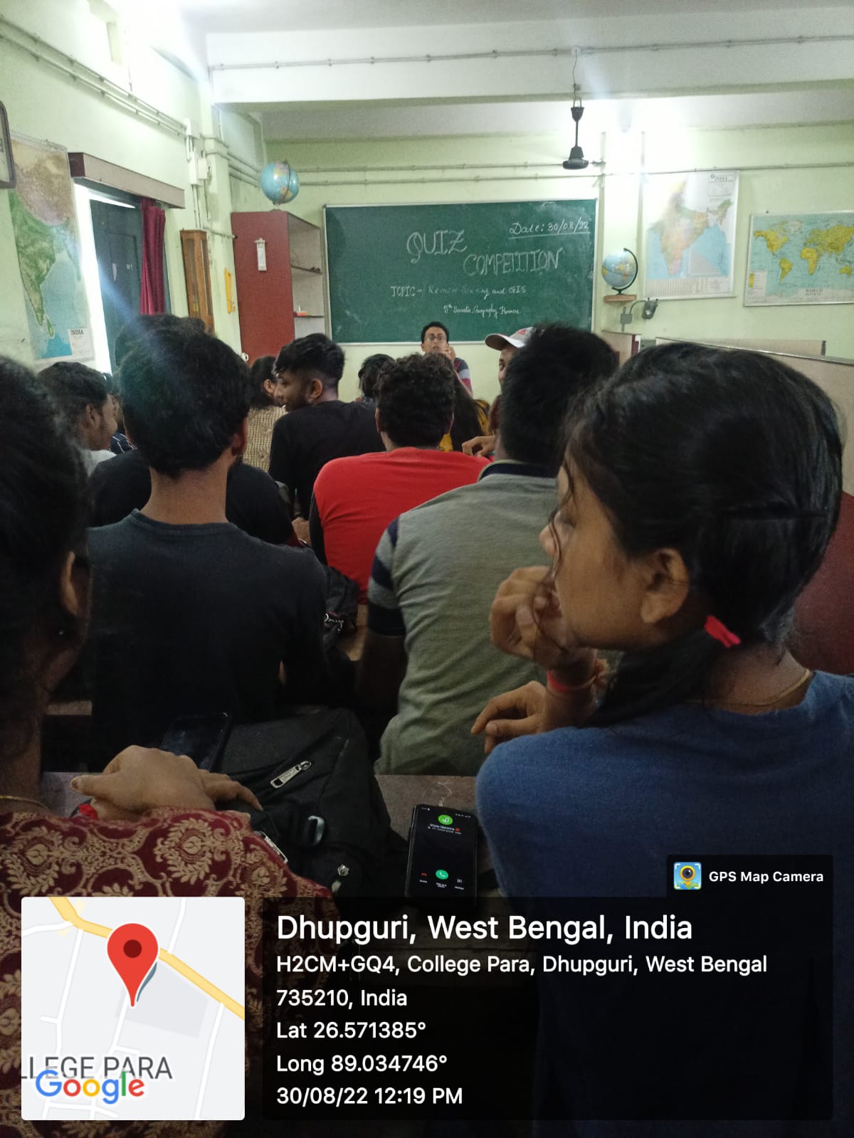
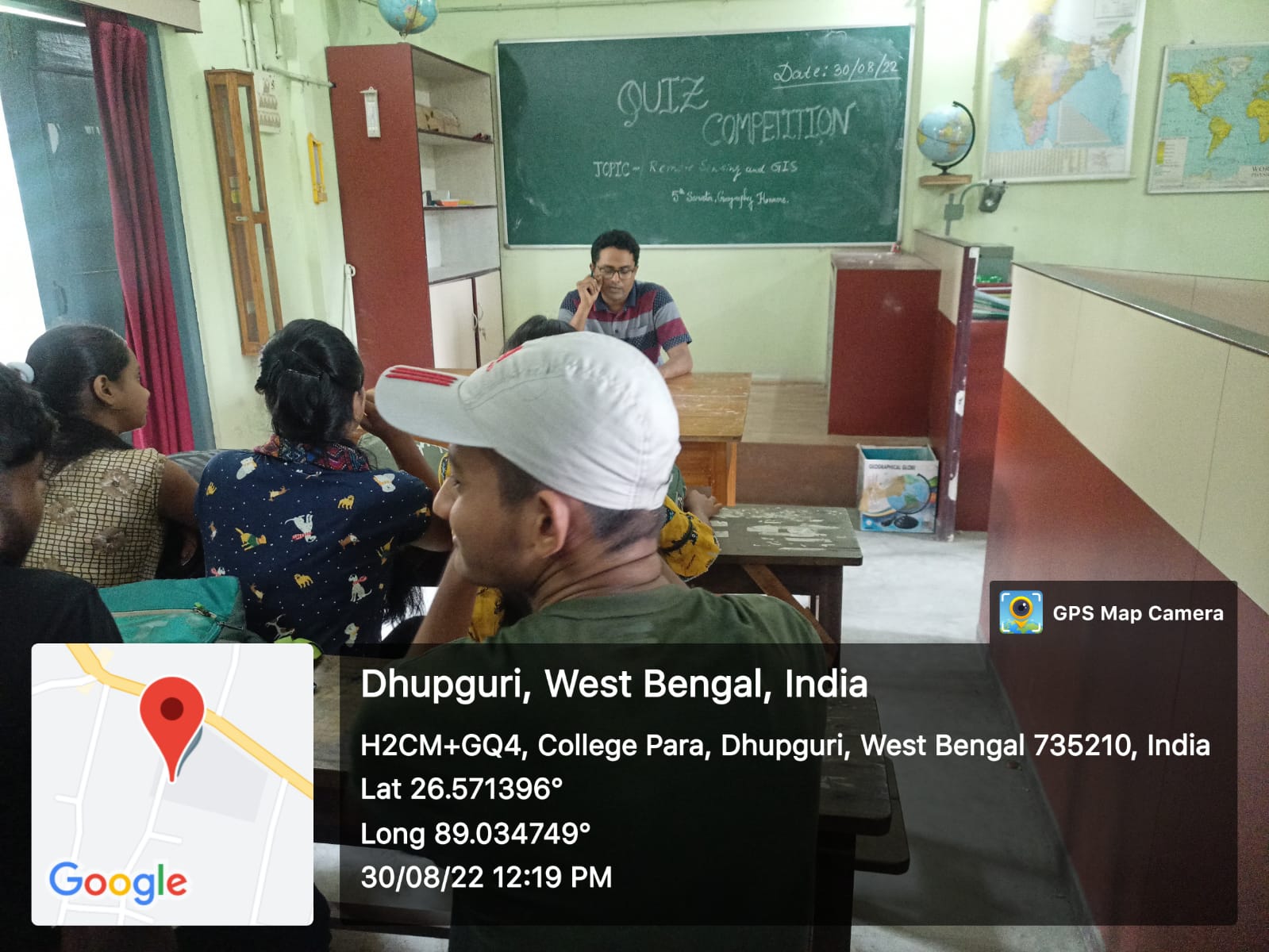
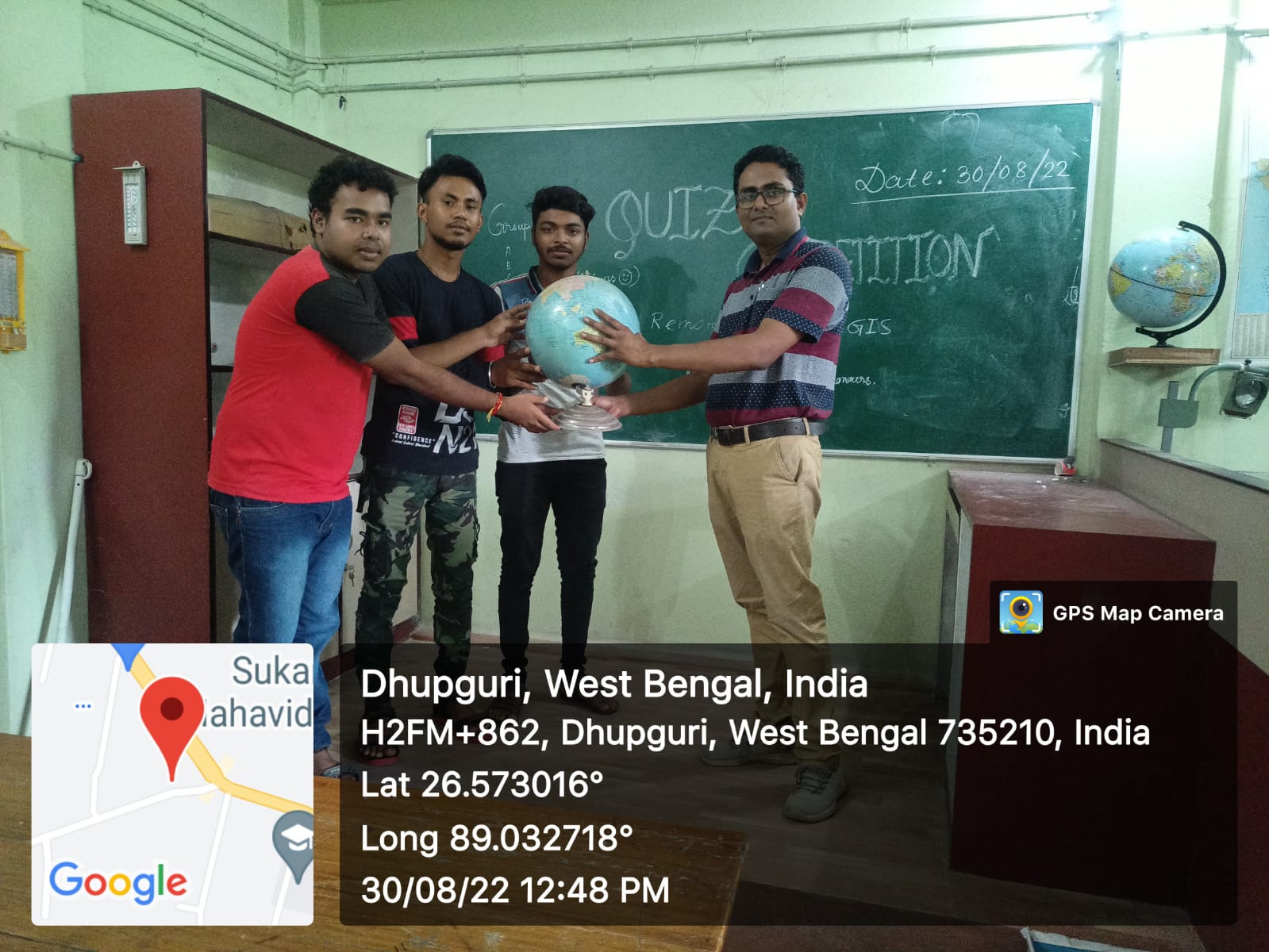
ACTIVITIES

Department of Geography

SUBJECT

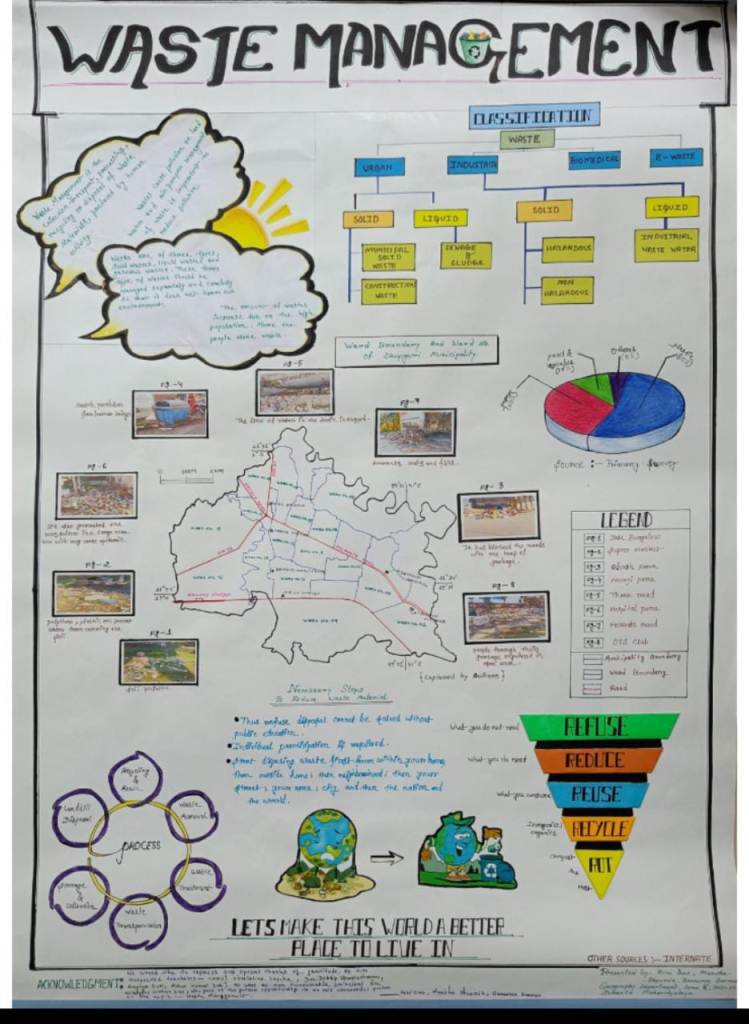
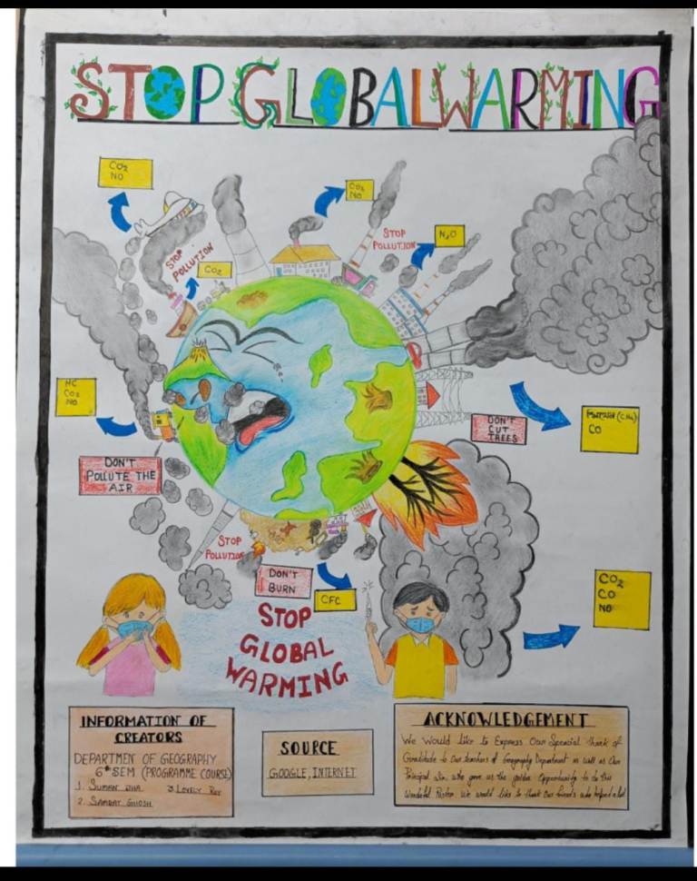
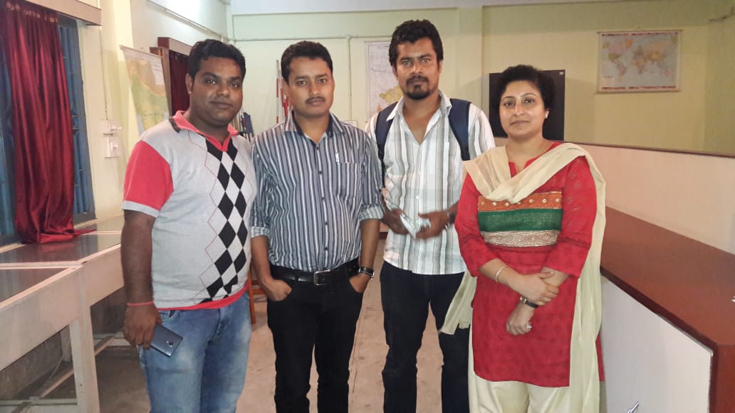
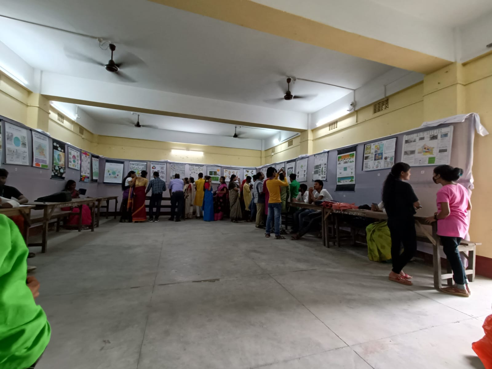
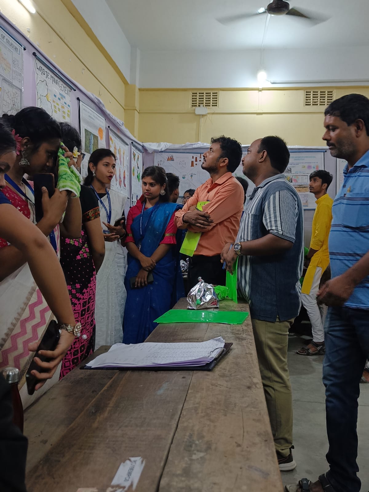
INTER SEMESTER POSTER COMPETITION
FIELD TOUR PELLING SIKKIM-2022
WEBINAR RELATED DOCUMENTS
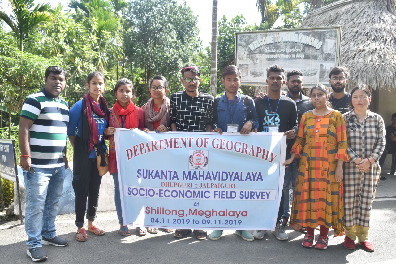
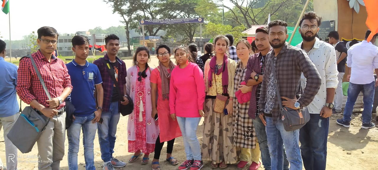
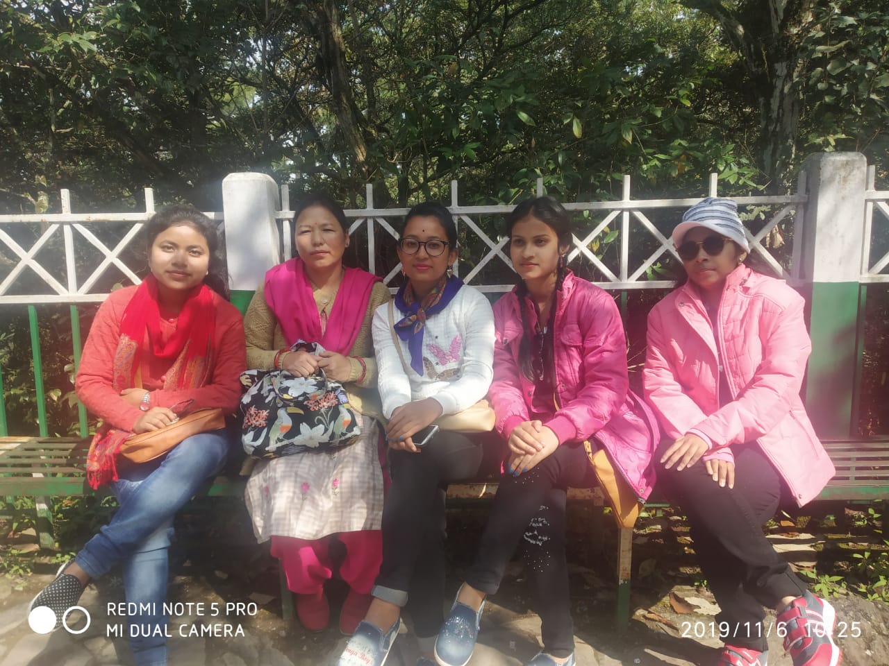
FIELD TOUR SHILLONG-2019

ONLINE EXAMINATION 2022
Sukanta Mahavidyalaya
Department of Geography

Download this Guidelines for Online submission of answer scripts of UG 1st, 2nd and 3rd semester examination.